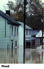
Specializing in completing SWMM
stormwater infra structure models. We've built entire cities and river
basin systems for review, analysis, & modeling to determine your
best infrastructure solution. Currently, our local Hillsborough County
SWMM
program has FEMA approval for Flood Plain
delineation and revisions. |
Top 10 Stormwater Modeling Tips
- Get County or Water
Management District topographic maps on disk.
- If they Have topo on disk,
check for roads, parcels and soils also.
- Find other large studies
completed in your basin study area, check:
- Municipal Engineering
Department
- Transportation
Departments
- Economic Planning Dept.
- Regional resources
- FEMA and USGS studies
- Find all the pipes and system
connections for flow, check if municipalities have any infrastructure
atlases, flooding or repair records.
- VISIT THE SITE. Often
interconnections can only be found onsite. They may have changed too,
residents often board up weirs to make their ponds larger.
- Compile existing site
infrastructure data to develop your basins data.
- Layout system and define
survey and data holes where additional information is required.
- Delineate basin areas.
Calculate Time of Concentrations.
- If TOC's or basins have a
great variation in size combine or break them up to create a 10-20%
variation.
- Return to steps 5 & 6....
Or better still Hire US NOW!!!
|